《农业气象学》课程教学资源(文献资料)Air masses
AirmassesReturninbolaremaritmeair万衣AirmassesThe idea that northerly winds (i.e. winds from the north)are cold,and southerly winds (those from the south)are warm (at least in thenorthem hemisphere)is quite common.Similarly,airthathas travelled overtheseapicks upmoisture,whileairtravelling over thelandis relativelydry.Thesesimpleconceptshelp in theunderstanding of airmasses.In polarand subtropical regionstherearelarge semi-pemanentanticyclones(highpressureareas).Theairresides inthesesystemsfora long time and is gradually influenced by the underlying surface -air at the poles is cooled and air in the tropics is wamed.The result isa large body of airwith little horizontal variation in temperature and moisture content.Sometimes there is a large outflow of air from the anticyclones, and these air masses mayapproachthe BritishIsles (usuallypolarair fromthenorthandtropicalairfromthesouth).However,ontheirjourneytheymaybemodifiedbycontactwiththeunderlyingsurface.Airthattravelsoverthesea(maritimeair)ismoistened,whereasthereis littlechangeinmoisturecontentofairthattravelsovertheland(continentalair).Forexample,airthathasbeentrappedinananticycloneovertheSaharainJuneslowlyheatsupanddries.Afterawhilethe air moves out of theanticyclone and may headfor the British Isles.On its way it may collect moisture over the Mediterranean Sea, butthe journey overSpain and France has little effect on its properties.The air then arrives here as a hot, dryair mass
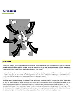
Air masses Air masses The idea that northerly winds (i.e. winds from the north) are cold, and southerly winds (those from the south) are warm (at least in the northern hemisphere) is quite common. Similarly, air that has travelled over the sea picks up moisture, while air travelling over the land is relatively dry. These simple concepts help in the understanding of air masses. In polar and subtropical regions there are large semi-permanent anticyclones (high pressure areas). The air resides in these systems for a long time and is gradually influenced by the underlying surface - air at the poles is cooled and air in the tropics is warmed. The result is a large body of air with little horizontal variation in temperature and moisture content. Sometimes there is a large outflow of air from the anticyclones, and these air masses may approach the British Isles (usually polar air from the north and tropical air from the south). However, on their journey they may be modified by contact with the underlying sur face. Air that travels over the sea (maritime air) is moistened, whereas there is little change in moisture content of air that travels over the land (continental air). For example, air that has been trapped in an anticyclone over the Sahara in June slowly heats up and dries . After a while, the air moves out of the anticyclone and may head for the British Isles. On its way it may collect moisture over the Mediterranean Sea, but the journey over Spain and France has little effect on its properties. The air then arrives here as a hot, dry air mass

Air masses affecting the British Isles can be broadly categorised in tems of their source and their path. This leads to four pos sible types.Tropicalmaritime-warmandmoist-Tropical continental - warm and dryPolarmaritime-coldand (fairly)moist--Polar continental - cold and dryTo these must be added another air mass - returning polar maritime - which consists of polar air that has moved southwards over the seaand then turns northwards andapproachesthe BritishIslesfromthesouth.In reality,the type of air mass affecting the British Isles only gives an indication of the type of weather that may occur.The actual weatherdepends upon the detailed history of theair,the speed ofmovement and the surface over which itflowsThe boundary between two different types of air mass is referred to as a front. It is common for the British Isles to be affected by sequencesof fronts; theseusually separating polarmaritimeand tropicalmaritimeair.Tropicalcontinental
Air masses affecting the British Isles can be broadly categorised in terms of their source and their path. This leads to four pos sible types. ▪ Tropical maritime - warm and moist ▪ Tropical continental - warm and dry ▪ Polar maritime - cold and (fairly) moist ▪ Polar continental - cold and dry To these must be added another air mass - returning polar maritime - which consists of polar air that has moved southwards over the sea and then turns northwards and approaches the British Isles from the south. In reality, the type of air mass affecting the British Isles only gives an indication of the type of weather that may occur. The actual weather depends upon the detailed history of the air, the speed of movement and the surface over which it flows. The boundary between two different types of air mass is referred to as a front. It is common for the British Isles to be affected by sequences of fronts; these usually separating polar maritime and tropical maritime air. Tropical continental
Tropical continental air usually comes with south-easterly or southerlyairstreams. It originates in North Africa and often travels over theMediterranean Sea, Spain and France before reaching the British Isles. Insummer, even easterly winds from central Europe or the Ukraine could beincluded in this category,as the continent becomes so hot at this time ofyear.The air picks up somemoisture over the Mediterranean (and perhapsSoutih orsouth-eastwindsbringtropicalthe Bay of Biscay),but overall the air tends to be quite dry and the skies arecontinental oirCtypicallycloudless.Strictlyspeaking,anairmasscooledfrombelowon itsnorthward journeyshould be stable.Sometimes,however,moisture may havefound its waytomedium levels in the atmosphere. Then, if there is a layer of unstable air anda trigger to set off convection, altocumulus castellanus clouds can develop,lookingliketurrets.Theseareoftentheforerunnertotremendousthunderstorms,whichcanoccurbydayornight.KThemajorityoftropicalcontinentalairstreamsgiveamarvellousheatwave(in summer), although plants and animals tend to be less appreciative of thistype of weather. The lack of moisture usually causes the visibility to be good.However,in the air there may be desertdust,fine soilor pollution particles,which can lead to moderate visibility(often describedas'heat haze').Also,thecloudlessskysometimeslooksmilkybecauseofpollutantsPolarcontinental
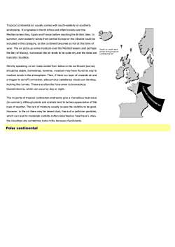
Tropical continental air usually comes with south-easterly or southerly airstreams. It originates in North Africa and often travels over the Mediterranean Sea, Spain and France before reaching the British Isles. In summer, even easterly winds from central Europe or the Ukraine could be included in this category, as the continent becomes so hot at this time of year. The air picks up some moisture over the Mediterranean (and perhaps the Bay of Biscay), but overall the air tends to be quite dry and the skies are typically cloudless. Strictly speaking, an air mass cooled from below on its northward journey should be stable. Sometimes, however, moisture may have found its way to medium levels in the atmosphere. Then, if there is a layer of unstable air and a trigger to set off convection, altocumulus castellanus clouds can develop, looking like turrets. These are often the forerunner to tremendous thunderstorms, which can occur by day or night. The majority of tropical continental airstreams give a marvellous heat wave (in summer), although plants and animals tend to be less appreciative of this type of weather. The lack of moisture usually causes the visibility to be good. However, in the air there may be desert dust, fine soil or pollution particles, which can lead to moderate visibility (often described as 'heat haze'). Also, the cloudless sky sometimes looks milky because of pollutants. Polar continental
A polar continental air mass originates in Scandinavia or Russia,and the air massreaches the British Isles when north-easterly or easterly winds becomeestablished. This tends to occur when there is a high pressure area somewhere tothenorthoftheBritishIsles,oftenoverScandinaviaitself.Polarcontinentalainmasses mainly affect the British Isles during the winter half of the year.Temperatures inpolar continentalairmasses arebelowaverage in winter, exceptEost or north-eostwinds bring polarperhaps to the lee of mountains.In summer, however,the temperatures tend tocontinental Qirbe above average.Themoisture content is lowintheseairmasses,especiallywhen theytaketheshort sea track in the Calais/Doverregion.This leads to clouds being generally wellbroken, and so the weather is fine and sunny.Air that has crossed the North Seabetween Denmark and Scotland is said to havetakena long sea track.Itthereforecollects moremoisture and clouds tend to form during its journey over the sea.Consequently, it is cloudy in eastern districts (with perhaps drizzle or snowflurries), but furtherinland there tends to be a mixture of cloud and sunshine.Visibility varies, generally being very good when air comes from Scandinavia, butmoderate or poor when the air originates in the industrialised regions of central oreastern Europe. Even in Aprilor May,the North Sea is cold and does little to modifythe air mass,apart from adding a littie unwelcome moisture. Southern England isparticularly chilled by polar continental air masses. Further north the airstream isless coldandthewind isless strongTropicalmaritime
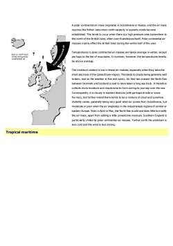
A polar continental air mass originates in Scandinavia or Russia, and the air mass reaches the British Isles when north-easterly or easterly winds become established. This tends to occur when there is a high pressure area somewhere to the north of the British Isles, often over Scandinavia itself. Polar continental air masses mainly affect the British Isles during the winter half of the year. Temperatures in polar continental air masses are below average in winter, except perhaps to the lee of mountains. In summer, however, the temperatures tend to be above average. The moisture content is low in these air masses, especially when they take the short sea track in the Calais/Dover region. This leads to clouds being generally well broken, and so the weather is fine and sunny. Air that has crossed the North Sea between Denmark and Scotland is said to have taken a long sea track. It therefore collects more moisture and clouds tend to form during its journey over the sea. Consequently, it is cloudy in eastern districts (with perhaps drizzle or snow flurries), but further inland there tends to be a mixture of cloud and sunshine. Visibility varies, generally being very good when air comes from Scandinavia, but moderate or poor when the air originates in the industrialised regions of central or eastern Europe. Even in April or May, the North Sea is cold and does little to modify the air mass, apart from adding a little unwelcome moisture. Southern England is particularly chilled by polar continental air masses. Further north the airstream is less cold and the wind is less strong. Tropical maritime
Tropical maritime air usually approaches the British Isles from the south-west.Its sourceregion is the subtropical Atlantic Ocean,typically the Azores area,although occasionally itmay come almost directly from the Caribbean. During its passage across the Atlantic, theair is cooled from belowas it passes overa progressively cooler ocean, and so it becomemore stable. While it cools down, little of its moisture is lost. It thereforereachessouth-west England or westem Ireland almost saturated,giving dull, warm, overcast1weather.South-westerfywindsbringropicamantmeLOn the coasts, sea fog is common in these tropical maritime south-westerlies. However, ifthe cloud base of the stratus or stratocumulus is several hundred feet, sea-level sites maybe saved from the fog, but on rising ground and hills there may be fog and drizzle. BodminMoor,Dartmoor,Dyfed,western Irelandand western Scotiland can be shrouded in mild,dampconditionswhetheritbewinterorsummer.Further inland,in the summer half of the yearat least, the low stratus maybe bumt off bythe sun and it could turn out to be quite warm, though still humid. In the lee of hills ormountainranges,thecloudssometimesbreakupandthereisalotofsunshine.Favouredlocations like north Somerset, North Wales, Northumberland and the Moray Firth can baskinspring-likeweatheronaJanuarydayIn a tropical maritime air mass, the nights are mild and damp, especially in mid-winter. InDecember and January the overcast skies result in there being little variation intemperature between day and night. However, if there are light winds and clear skies, fogmayform inlandovernight.Polarmaritime
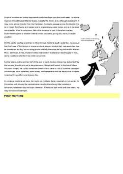
Tropical maritime air usually approaches the British Isles from the south-west. Its source region is the subtropical Atlantic Ocean, typically the Azores area, although occasionally it may come almost directly from the Caribbean. During its passage across the Atlantic, the air is cooled from below as it passes over a progressively cooler ocean, and so it becomes more stable. While it cools down, little of its moisture is lost. It therefore reaches south-west England or western Ireland almost saturated, giving dull, warm, overcast weather. On the coasts, sea fog is common in these tropical maritime south-westerlies. However, if the cloud base of the stratus or stratocumulus is several hundred feet, sea-level sites may be saved from the fog, but on rising ground and hills there may be fog and drizzle. Bodmin Moor, Dartmoor, Dyfed, western Ireland and western Scotland can be shrouded in mild, damp conditions whether it be winter or summer. Further inland, in the summer half of the year at least, the low stratus may be burnt off by the sun and it could turn out to be quite warm, though still humid. In the lee of hills or mountain ranges, the clouds sometimes break up and there is a lot of sunshine. Favoured locations like north Somerset, North Wales, Northumberland and the Moray Firth can bask in spring-like weather on a January day. In a tropical maritime air mass, the nights are mild and damp, especially in mid-winter. In December and January the overcast skies result in there being little variation in temperature between day and night. However, if there are light winds and clear skies, fog may form inland overnight. Polar maritime
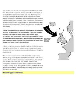
Polarmaritimeairis themostcommon type ofairmass affecting the BritishIsles.The air has its source in the Canadian Arctic orthe Greenland area. Itreaches the British Islesfromthe west or north-west after having swungaround the westem side of a depression. As the cold air travels over therelatively warm sea, it is warmed from below and becomes unstable.Unstableairstreams tend to produce convection,and so cumulus clouds, cumulonimbuscloudsandshowersarelikelyinpolarmaritimeair.Othercharacteristicsofthe1air are that it is cool (especially in summer),fairly moistand associated withgood visibility.1Inwinter,mostoftheconvectionisinitiatedovertheAtlantic,andshowershitthe coasts, spreading inland if the winds are strong.The Scottish and Welshmountains often shelter the eastem sideof Britain,although,withanorth-westerlywind,some showers sneak throughtheCheshireGapto reachBimingham and perhaps London. With a westerly wind the winter showers canNorth-westerly orwesterlywinds公cross Glasgow and central Scotland to reach Edinburgh and Fife; others travelbring,pofarmaritimeairup the Bristol Channel to affect Cardiff and Bristol.In spring and summer, convection clouds tend to be set off inland by daytimeheating. Now, the shelter of the western mountains is less important,andshowersorshort-livedthunderstormscanoccuralmostanywhere.Atnighttheclouds disperse.After a low has crossedeastwards over the British Isles, winds'veer'(aclockwise change in wind direction) to a northerly point,and true arctic air mayreachus.This is sometimes referredto as arcticmaritime air.It is similar topolarmaritimeairbuttendsto bemoreunstable,colderanddrier.Consequently,showers ofrain,snow, sleetor hail often occur on northerncoasts and over high ground. The Highlands of Scotland usually take the bruntof a 'screaming northerly', with blizzards on low and high ground. Elsewheretheretendtobeclearskies.Returningpolarmaritime
Polar maritime air is the most common type of air mass affecting the British Isles. The air has its source in the Canadian Arctic or the Greenland area. It reaches the British Isles from the west or north-west after having swung around the western side of a depression. As the cold air travels over the relatively warm sea, it is warmed from below and becomes unstable. Unstable airstreams tend to produce convection, and so cumulus clouds, cumulonimbus clouds and showers are likely in polar maritime air. Other characteristics of the air are that it is cool (especially in summer), fairly moist and associated with good visibility. In winter, most of the convection is initiated over the Atlantic, and showers hit the coasts, spreading inland if the winds are strong. The Scottish and Welsh mountains often shelter the eastern side of Britain, although, with a north-westerly wind, some showers sneak through the Cheshire Gap to reach Birmingham and perhaps London. With a westerly wind the winter showers can cross Glasgow and central Scotland to reach Edinburgh and Fife; others travel up the Bristol Channel to affect Cardiff and Bristol. In spring and summer, convection clouds tend to be set off inland by daytime heating. Now, the shelter of the western mountains is less important, and showers or short-lived thunderstorms can occur almost anywhere. At night the clouds disperse. After a low has crossed eastwards over the British Isles, winds 'veer' (a clockwise change in wind direction) to a northerly point, and true arctic air may reach us. This is sometimes referred to as arctic maritime air. It is similar to polar maritime air but tends to be more unstable, colder and drier. Consequently, showers of rain, snow, sleet or hail often occur on northern coasts and over high ground. The Highlands of Scotland usually take the brunt of a 'screaming northerly', with blizzards on low and high ground. Elsewhere there tend to be clear skies. Returning polar maritime
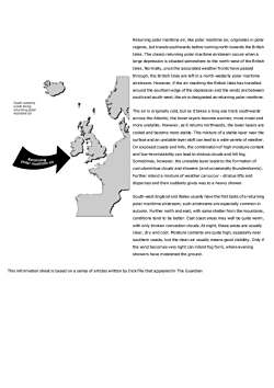
Returning polar maritime air, like polar maritime air, originates in polarregions, but travels southwards before turning north towards the BritishIsles.The classic returning polar maritime airstream occurs when alarge depression is situated somewhere to the north-west of the BritishIsles.Normally,oncetheassociatedweatherfrontshavepassedthrough, the British Isles are left in a north-westerly polar maritimeAairstream. However,if the airreaching the British Isles has travelledaround the southern edge of the depression and the winds are betweensouthand south-west,theair is designated as returning polar maritimeSouth-westeriy9winds bringreturningpofarThe air is originally cold,but as ittakes a long sea track southwardsmaritimeairacross the Atlantic, the lower layers become warmer,more moistandmore unstable. However, as it retums northwards, the lower layers arecooledandbecomemorestable.Thismixtureofastablelayernearthesurfaceandanunstablelayeraloftcanleadtoawidevarietyofweather.On exposedcoasts and hills,thecombinationof highmoisture contentand low-levelstability can lead to stratus clouds and hill fog.Sometimes,however,the unstablelayer leadsto theformationofaremurmigealcumulonimbus clouds andshowers (andoccasionally thunderstorms).Further inland a mixtureof weather canoccur-stratus lifts anddisperses and then suddenly gives way to a heavy shower.South-west England and Wales usually have the first taste ofa returningpolar maritime airstream; such airstreams are especially common inautumn.Furthernorthandeast,withsomeshelterfromthemountains,conditions tend to be better. East coast areas may well be quite wam,with only broken convection clouds.At night,these areas are usuallyclear, dry and cool. Moisture contents are quite high, especially nearsouthem coasts,but the clean air usuallymeans good visibility.Only ifthe wind becomes very light can inlandfog form, where eveningshowershavemoistenedthegroundThis information sheet is based on a series of articles written by Dick File that appeared in The Guardian
Returning polar maritime air, like polar maritime air, originates in polar regions, but travels southwards before turning north towards the British Isles. The classic returning polar maritime airstream occurs when a large depression is situated somewhere to the north-west of the British Isles. Normally, once the associated weather fronts have passed through, the British Isles are left in a north-westerly polar maritime airstream. However, if the air reaching the British Isles has travelled around the southern edge of the depression and the winds are between south and south-west, the air is designated as returning polar maritime. The air is originally cold, but as it takes a long sea track southwards across the Atlantic, the lower layers become warmer, more moist and more unstable. However, as it returns northwards, the lower layers are cooled and become more stable. This mixture of a stable layer near the surface and an unstable layer aloft can lead to a wide variety of weather. On exposed coasts and hills, the combination of high moisture content and low-level stability can lead to stratus clouds and hill fog. Sometimes, however, the unstable layer leads to the formation of cumulonimbus clouds and showers (and occasionally thunderstorms). Further inland a mixture of weather can occur - stratus lifts and disperses and then suddenly gives way to a heavy shower. South-west England and Wales usually have the first taste of a returning polar maritime airstream; such airstreams are especially common in autumn. Further north and east, with some shelter from the mountains, conditions tend to be better. East coast areas may well be quite warm, with only broken convection clouds. At night, these areas are usually clear, dry and cool. Moisture contents are quite high, especially near southern coasts, but the clean air usually means good visibility. Only if the wind becomes very light can inland fog form, where evening showers have moistened the ground. This information sheet is based on a series of articles written by Dick File that appeared in The Guardian
按次数下载不扣除下载券;
注册用户24小时内重复下载只扣除一次;
顺序:VIP每日次数-->可用次数-->下载券;
- 《农业气象学》课程教学资源(文献资料)Agrometeorology.doc
- 《农业气象学》课程教学资源(文献资料)The atmosphere.doc
- 《农业气象学》课程教学资源(文献资料)Thunderstorms.doc
- 《农业气象学》课程教学资源(文献资料)Weather forecasting.doc
- 《农业气象学》课程教学资源(文献资料)Clouds 2/2.doc
- 《农业气象学》课程授课教案(石河子大学:胡晓棠).doc
- 《农业气象学》课程教学大纲(农学院各类专业用).pdf
- 《农业信息技术》课程教学课件(讲稿)第二章 精准农业技术.pdf
- 《农业信息技术》课程教学课件(讲稿)第四章 遥感技术.pdf
- 《农业信息技术》课程教学课件(讲稿)第一章 绪论.pdf
- 《农业信息技术》课程教学课件(讲稿)第三章 全球定位系统与应用(Global Positioning System,GPS).pdf
- 《农业信息技术》课程教学课件(讲稿)第七章 作物模拟模型.pdf
- 《农业信息技术》课程教学课件(讲稿)第八章 农业专家系统.pdf
- 《农业信息技术》课程教学课件(讲稿)第六章 决策支持系统.pdf
- 《农业信息技术》课程教学课件(讲稿)第五章 地理信息系统.pdf
- 《农业信息技术》课程授课教案(石河子大学:蒋桂英).pdf
- 《农业信息技术》课程教学资源(讲义,共八章).pdf
- 《农业信息技术》课程教学大纲 Agricultural Information Technology.pdf
- 《种子生产学》课程教学资源(文献资料)水稻的一生.doc
- 《种子生产学》课程教学课件(PPT讲稿)玉米授粉过程.ppt
- 《农业气象学》课程教学资源(文献资料)Clouds 1/2.doc
- 《农业气象学》课程教学课件(PPT讲稿)第四章 大气中的水分.ppt
- 《农业气象学》课程教学课件(PPT讲稿)第五章 气压与风.ppt
- 《农业气象学》课程教学课件(PPT讲稿)第三章 热量.ppt
- 《农业气象学》课程教学课件(PPT讲稿)第二章 辐射.ppt
- 《农业气象学》课程教学课件(PPT讲稿)第六章 天气及农业气象灾害.ppt
- 《农业气象学》课程教学课件(PPT讲稿)第一章 大气.ppt
- 《农业气象学》课程教学课件(PPT讲稿)第七章 气候与农业气候.ppt
- 《耕作学》课程教学大纲 Farming System(农学专业).docx
- 《耕作学》课程考试大纲 Testing Principle Farming System.pdf
- 《耕作学》课程授课教案(石河子大学:刘建国).doc
- 《耕作学》课程课程习题集(含参考答案).doc
- 《耕作学》课程教学资源(PPT课件)第十章 耕作制度发展与趋势展望.ppt
- 《耕作学》课程教学资源(PPT课件)第十一章 信息技术在现代农业中的应用.ppt
- 《耕作学》课程教学资源(PPT课件)第九章 土壤耕作 Soil Tillage.ppt
- 《耕作学》课程教学资源(PPT课件)第八章 农田养护 Conservation of crop land.ppt
- 《耕作学》课程教学资源(PPT课件)第六章 轮作与连作.ppt
- 《耕作学》课程教学资源(PPT课件)第七章 农牧结合的种植制度.ppt
- 《耕作学》课程教学资源(PPT课件)第四章 复种.ppt
- 《耕作学》课程教学资源(PPT课件)第十章 双语教学 The Evolvemental history, present state and Perspective of Farming system.ppt
