同济大学:《地质工程导论》课程电子教案(课件讲稿)Chapter VIII Review on current status and challenging issues of land subsidence in China(Part II)
CHAPTER VIII:Review on current status and challenging issues of land subsidence in China (Part II)
CHAPTER VIII: Review on current status and challenging issues of land subsidence in China (Part II)
New words and phrases releasing water pressure model减水压模型 water level model水力模型 soil layer compression model土层固结模型 life gyration model螺旋模型(时间序列模型) semi-three-dimensional groundwater numerical model准三维地下 水数值模型 couple耦合 rheological model流变模型 one-dimensional consolidation model一维固结模型
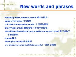
New words and phrases releasing water pressure model 减水压模型 water level model 水力模型 soil layer compression model 土层固结模型 life gyration model 螺旋模型(时间序列模型) semi-three-dimensional groundwater numerical model 准三维地下 水数值模型 couple 耦合 rheological model 流变模型 one-dimensional consolidation model 一维固结模型
New words and phrases interlayer drainage层间排水 life evolution models生命进化模型 Poisson gyration model泊松回旋模型 gray model黑箱模型 statistic method统计方法 regression analysis method回归分析方法 automatic monitoring system自动监测系统 Wire-flex extensometers可伸缩变形测量计 deformation变形 settlement沉降 cement tubes水泥管
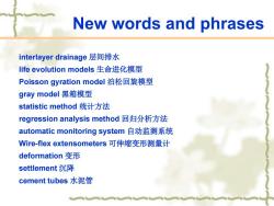
New words and phrases interlayer drainage 层间排水 life evolution models 生命进化模型 Poisson gyration model 泊松回旋模型 gray model 黑箱模型 statistic method 统计方法 regression analysis method 回归分析方法 automatic monitoring system 自动监测系统 Wire-flex extensometers 可伸缩变形测量计 deformation 变形 settlement 沉降 cement tubes 水泥管
New words and phrases cast-iron tubes铸铁管 flexible deformation弹性变形 rigidity刚性 pagoda-type塔式 logged记录,采集 global positioning systems全球定位系统 automatic data acquisition system自动数据采集系统. dua-band双波段的 synthesize analysis综合分析 optimization优化
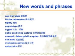
New words and phrases cast-iron tubes 铸铁管 flexible deformation 弹性变形 rigidity 刚性 pagoda-type 塔式 logged 记录,采集 global positioning systems 全球定位系统 automatic data acquisition system 自动数据采集系统. dual-band 双波段的 synthesize analysis 综合分析 optimization 优化
New words and phrases land subsidence hazard maps地面沉降灾害地图 accumulative land subsidence累计地面沉降量 the critical subsidence临界沉降量 contour map等直线图 preventive and remediation measures防治方法 administrative regulation行政管理 flood-proof wall防汛墙 artificial recharging人工▣灌 benchmarks水准点 silty clay soils淤泥质黏土 mucky soft soil淤泥质软土 porewater pressure孔隙水压力
New words and phrases land subsidence hazard maps 地面沉降灾害地图 accumulative land subsidence 累计地面沉降量 the critical subsidence 临界沉降量 contour map 等直线图 preventive and remediation measures 防治方法 administrative regulation 行政管理 flood-proof wall 防汛墙 artificial recharging 人工回灌 benchmarks 水准点 silty clay soils 淤泥质黏土 mucky soft soil 淤泥质软土 porewater pressure 孔隙水压力

New words and phrases delayed consolidation theories延迟固结理论 creep theories蠕变理论 continental shelf大陆架 surface catchment watersheds地表水流域
New words and phrases delayed consolidation theories 延迟固结理论 creep theories 蠕变理论 continental shelf 大陆架 surface catchment watersheds 地表水流域
3.Research and development on land subsidence 3.1.Theoretical modeling of land subsidence A number of engineering geological models have been developed to assess and predict land subsidence in China.The models can be divided into the following two categories: Category A:This is basically the releasing water pressure model consisting of water level model and soil layer compression model. Category B:This is the life gyration model directly including the relations between subsidence and time
3. Research and development on land subsidence 3.1. Theoretical modeling of land subsidence A number of engineering geological models have been developed to assess and predict land subsidence in China. The models can be divided into the following two categories: Category A: This is basically the releasing water pressure model consisting of water level model and soil layer compression model. Category B: This is the life gyration model directly including the relations between subsidence and time
3.Research and development on land subsidence 3.2.Assessment of economic loss due to subsidence At present,methods to evaluate loss due to land subsidence have gradually developed.There are three types of methods to calculate the economic loss due to land subsidence.They are the investigation-based statistic method,the statistic-based prediction method and the regression analysis method
3. Research and development on land subsidence 3.2. Assessment of economic loss due to subsidence At present, methods to evaluate loss due to land subsidence have gradually developed. There are three types of methods to calculate the economic loss due to land subsidence. They are the investigation-based statistic method, the statistic-based prediction method and the regression analysis method
3.Research and development on land subsidence The main evaluation contents include direct and indirect economic loss.Ikenhara (1995)noted that the ratio of the indirect economic loss over the direct economic loss is about 10.In Tianjin,the total economic loss was RMB$189.6 billion from 1959 to 1993.The direct loss was RMB$17.2 billion and the related loss was RMB$172.4 billion.In the areas of Suzhou,Wuxi and Changzhou,the economic loss due to land subsidence was also assessed
3. Research and development on land subsidence The main evaluation contents include direct and indirect economic loss. Ikenhara (1995) noted that the ratio of the indirect economic loss over the direct economic loss is about 10. In Tianjin, the total economic loss was RMB$189.6 billion from 1959 to 1993. The direct loss was RMB$17.2 billion and the related loss was RMB$172.4 billion. In the areas of Suzhou, Wuxi and Changzhou, the economic loss due to land subsidence was also assessed
3.Research and development on land subsidence In the three cities,the total economic loss is about RMB$3.3 billion per year.The direct economic loss is about RMB$300 million per year and the related economic loss is RMB$30 billion per year.The exact economic loss due to land subsidence in Shanghai is not known yet(Wang and Zuo,1993)
3. Research and development on land subsidence In the three cities, the total economic loss is about RMB$3.3 billion per year. The direct economic loss is about RMB$300 million per year and the related economic loss is RMB$30 billion per year. The exact economic loss due to land subsidence in Shanghai is not known yet (Wang and Zuo, 1993)
按次数下载不扣除下载券;
注册用户24小时内重复下载只扣除一次;
顺序:VIP每日次数-->可用次数-->下载券;
- 同济大学:《地质工程导论》课程电子教案(课件讲稿)Chapter VII Review on current status and challenging issues of land subsidence in China(Part I).pdf
- 同济大学:《地质工程导论》课程电子教案(课件讲稿)Chapter VI Groundwater Pollution - Remediation.pdf
- 同济大学:《地质工程导论》课程电子教案(课件讲稿)Chapter V Landslide.pdf
- 同济大学:《地质工程导论》课程电子教案(课件讲稿)Chapter IV Hydrogeology.pdf
- 同济大学:《地质工程导论》课程电子教案(课件讲稿)Chapter III Geology.pdf
- 同济大学:《地质工程导论》课程电子教案(课件讲稿)Chapter II Common ground in engineering geology, soil mechanics and rock mechanics - past, present and future.pdf
- 同济大学:《地质工程导论》课程电子教案(课件讲稿)Chapter I Introduction(负责人:叶为民).pdf
- 同济大学:《地质工程导论》课程教学资源(教案讲义)An Outline of Engineering Geology(An Outline of Geological Engineering).pdf
- 北方工业大学:城乡规划《城市地理学》课程教学大纲.pdf
- 《土壤地理学》课程教学资源(PPT课件讲稿)中国主要农业区土壤.pdf
- 天津农学院:《空间数据库技术》课程教学资源(讲义,共九章,主讲:赵娜).pdf
- 山西师范大学:地理信息科学专业教学大纲(合集).pdf
- 山西师范大学:人文地理与城乡规划专业教学大纲(合集).pdf
- 山西师范大学:自然地理与资源环境专业教学大纲(合集).pdf
- 山西师范大学:地理科学专业教学大纲(合集).pdf
- 兰州大学:《大气探测学》课程教学资源(PPT课件讲稿)第八章 地面风的观测.ppt
- 兰州大学:《大气探测学》课程教学资源(PPT课件讲稿)第二章 云的观测.ppt
- 《地学前缘(中国地质大学(北京); 北京大学)》:古气候数值模拟——进展评述(中国科学院:丁仲礼、熊尚发).pdf
- 《大气科学》:关于亚洲夏季风爆发的动力学研究的若干近期进展(吴国雄、段安民、刘屹岷、颜京辉、刘伯奇、任素玲、张亚妮、王同美、梁潇云、关月).pdf
- 上海交通大学:《中国的世界文化与自然遗产 The World Cultural and Natural Heritage Sites in China》课程教学资源(PPT课件,2015)第二章 世界遗产的物质基础与构景要素(2/2).ppt
- 同济大学:《地质工程导论》课程电子教案(课件讲稿)Chapter IX The disposal of high-level radioactive waste.pdf
- 同济大学:《地质工程导论》课程电子教案(课件讲稿)Chapter X The engineering geology of the TABARAK ABAD Dam.pdf
- 南京农业大学:《生物地球化学(双语教学)》课程教学大纲.pdf
- 中国科学院大学:地球与行星科学学院地球物理学专业课程教学大纲汇编.doc
- 中国科学院大学:地球与行星科学学院地质学专业一级与二级学科课程设置及课程大纲汇编(2010).doc
- 中国科学院大学:地球与行星科学学院大气科学专业课程设置及课程教学大纲汇编(第二版).doc
- 中国科学院大学:地球与行星科学学院海洋科学专业课程设置及课程教学大纲汇编.doc
- 中国科学院大学:地球与行星科学学院测绘科学与技术专业课程设置与课程教学大纲汇编.doc
- 中国科学院大学:地球与行星科学学院土木工程专业课程设置及课程教学大纲汇编.doc
- 中国科学院大学:地球与行星科学学院地质资源与地质工程专业课程教学大纲汇编.doc
- 西安建筑科技大学:《工程地质学》课程教学资源(PPT课件)工程地质学实验讲稿.ppt
- 西安建筑科技大学:《工程地质学》课程教学大纲 The engineering geology.pdf
- 安徽理工大学:《全球卫星导航定位原理与应用》课程教学习题集(GNSS定位原理)计算题-习题.docx
- 安徽理工大学:《全球卫星导航定位原理与应用》课程教学习题集(GNSS定位原理)计算题-参考答案.docx
- 安徽理工大学:《全球卫星导航定位原理与应用》课程教学习题集(GNSS定位原理)名词解释.docx
- 安徽理工大学:《全球卫星导航定位原理与应用》课程教学习题集(GNSS定位原理)简答题-习题.docx
- 安徽理工大学:《全球卫星导航定位原理与应用》课程教学习题集(GNSS定位原理)简答题-参考答案.docx
- 安徽理工大学:《全球卫星导航定位原理与应用》课程教学习题集(GNSS定位原理)判断题-习题.docx
- 安徽理工大学:《全球卫星导航定位原理与应用》课程教学习题集(GNSS定位原理)判断题-参考答案.docx
- 安徽理工大学:《全球卫星导航定位原理与应用》课程教学习题集(GNSS定位原理)填空题-习题.docx
